
Noblesville ZIP Code Coverage
Official USPS lists associate three codes with the Noblesville post-office label. The city Downtown Streetscape Master Plan maps 46060 and 46062 in the Noblesville area, but it also warns that ZIP codes are delivery routes rather than geographic boundaries. No official street-by-street partition or firm carrier-route versus post-office-box division was located for all three codes. The safe method is to check each complete address through USPS.
| ZIP | Areas Covered | Post Office Label | Use Note |
|---|---|---|---|
| 46060 | Downtown and Noblesville-area addresses shown in city planning material | Noblesville, IN | Verify the full street address with USPS |
| 46061 | Official Noblesville sorting designation; exact delivery geography not published in reviewed sources | Noblesville, IN | Do not infer city limits from the code |
| 46062 | Noblesville-area addresses shown in city planning material | Noblesville, IN | Confirm the precise delivery label |
This ZIP code directory records what the official sources support and leaves uncertain boundaries unclaimed. A code can help group records, but a current USPS result and a county parcel are stronger evidence for one address.
Verify Noblesville ZIP Codes
The USPS ZIP Code Lookup is the first stop for a delivery label. Its dynamic form supports a street-address route with city and state, as well as ZIP-oriented lookup modes. Enter the full address as delivered, keep apartment or unit data when applicable, and retain the returned city, state, and ZIP. A directory spelling or parcel address may not use the same abbreviations.
| USPS field | Input | Purpose |
|---|---|---|
| Street address | Exact delivery address | Find the code assigned to one address |
| City | Noblesville or the known postal city | Pairs the street with its postal label |
| State | Indiana | Prevents a same-name place match |
| ZIP Code | Five-digit code when known | Checks ZIP-to-city or alternate modes |
The successful, page-matched manifest capture below shows the official USPS ZIP lookup.
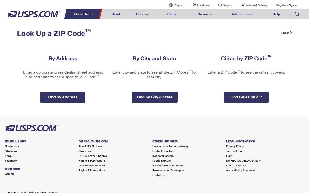
Use that postal result as a delivery check, then compare the same address in the Hamilton County parcel tools.
Find Noblesville Residents by ZIP
A ZIP code can reduce a broad name search, but no single official portal returns a complete roll of Noblesville residents by ZIP. Different databases represent different groups: parcels, licenses, business filings, unclaimed property, or registered voters. State what is being counted before treating a result as a local list.
- Verify the exact address and its delivery ZIP through USPS. Save the returned postal city and date.
- Search Hamilton County Property Reports by partial property address and, when relevant, mailing address. The public box has no dedicated ZIP-only control.
- Read the parcel report or GIS fields for the location ZIP, owner-mailing ZIP, tax unit, township, legal description, and corporate-limit context.
- Use ZIP filters only in the record set that fits the question, such as a license, business, or unclaimed-property search. Verify a named person through another source.
- Once the search narrows to a street, use the Noblesville street directory workflow for parcel-by-parcel work.
A voter lookup confirms an individual registration and polling place. It is not a public ZIP browser. A county voter-file request uses VRG-24, has requester and use restrictions, and should not be treated as a general resident download.
Noblesville ZIP Address Terms
One Noblesville property can have several valid address fields because each record keeper has a different task. Mixing them creates false resident matches. The physical parcel may sit in one tax unit while the owner receives mail elsewhere. A historic directory may use an old house number, and a court filing can retain an address that later changed.
- ZIP Code
- A USPS delivery and sorting code. It is not a city boundary.
- ZIP+4
- The basic five-digit code plus four digits that refine a delivery segment.
- ZCTA
- A Census statistical area that approximates groups of ZIP delivery points. It may be noncontiguous and is not a municipal line.
- Situs address
- The physical location of a parcel in property and GIS records.
- Mailing address
- The destination for an owner's tax mail, which can differ from the property.
- Carrier route
- A USPS delivery path within a ZIP, not a list of city residents.
Legal descriptions supply a more durable parcel key. Subdivision, block, lot, section, township, and range can bridge a modern address to older deeds even when a house number changed.
Noblesville ZIPs Versus City Limits
A Hamilton County address can use Noblesville as its postal city without sitting inside the incorporated city. Confirm the tax unit, political township, and corporate-limit field in GIS or the property report. The county 911 Address Coordinators approve and record street and subdivision names, while the City of Noblesville has its own addressing contact. Those roles are not the same as USPS delivery assignment.
The city's facility listings offer a useful local test. Different entries present City Hall conference rooms with 46060 and 46062 labels. That inconsistency is a prompt to verify the exact address, not proof that one building occupies two ZIP codes. Compare the facility listing with the city plan and USPS result.
Boundary rule. Treat 46060, 46061, and 46062 as postal labels. Use parcel and city records for municipal jurisdiction.
Hamilton County tax-unit labels can also include Noblesville City, Noblesville Township, Noblesville/Fall, Noblesville/Wayne, and Noblesville SE. The shared place name does not make these units interchangeable.
Downtown Noblesville Postal Geography
The Downtown Streetscape Master Plan gives a concrete area for comparing record layers. Its study bounds are Wayne Avenue, 11th Street, Hannibal Street, and John Street. The plan shows 46060 and 46062 in the broader Noblesville area and explains why ZIP and Census ZCTA polygons should not stand in for city limits.
The White River adds another map boundary that a ZIP cannot explain. A parcel beside the river, greenway, cemetery, alley, or public tract may not have the same relationship to nearby addresses as a normal lot. Riverside Cemetery records and nearby property data therefore belong to their own custodians even when the postal label looks uniform.
Noblesville's 2020 Census population was 69,604. That city figure should not be divided among ZIP codes as though each code were a clean municipal slice. Census place totals, ZCTAs, USPS routes, and GIS parcels measure different things.
Noblesville Records With ZIP Fields
The county GIS layer exposes location ZIP and owner-mailing ZIP fields, along with street, parcel, owner, legal description, lot, block, subdivision, and tax data. A technical query can group parcels by ZIP and street, subject to a 2,000-feature limit. Property Reports accepts partial property and mailing addresses but does not promise a ZIP-only search. Current ownership is updated five times each week.
| Record source | ZIP use | What the results represent |
|---|---|---|
| Hamilton GIS | Location and owner-mailing ZIP attributes | Parcels and recorded ownership fields |
| Indiana professional licenses | ZIP search control | Public credential holders or facilities |
| Indiana business search | Advanced address ZIP field | Entity filings and affiliations |
| Indiana unclaimed property | Name, city, ZIP, or property ID | Claim entries, not a resident roll |
| IndianaVoters | No public ZIP filter documented | Individual registration confirmation |
These sources cannot be added together into a population total. A parcel may have an off-site owner, a business can list an agent, and a license may use a work or facility location. Label every extracted row by its actual record role.
Historical Noblesville ZIP Research
ZIP codes do not solve older address research. The Noblesville Preservation Alliance warns that house numbers changed and that the 1916, and possibly 1920, directories use the earlier system. The exact conversion year and crosswalk were not found. Search the old street number alongside an Original Plat block and lot, Sanborn building footprint, deed legal description, and known adjacent parcels.
HEPL directories and criss-cross volumes provide dated occupant or business lines. The 1916 volume has resident, business, and street-by-number sections. Later criss-cross holdings begin in 1976 with gaps. Pair these sources with deeds or census records because a directory entry is a historical snapshot, not proof of current residence.
Note: Preserve both the source's printed address and the modern verified address instead of silently replacing one with the other.
Noblesville ZIP Directory Limits
A ZIP-wide count must name its universe. GIS can count parcel features, a qualified voter-file request can count records under its rules, and state portals can count licenses, businesses, or claim entries. None is a count of everyone living in that ZIP. USPS assigns delivery routes, not a public household roster.
A protected voter address, off-site tax-mail address, shared business address, post-office box, or institutional code may be a valid result without revealing a home. Do not fill a blank field from an unrelated commercial profile. Record the source, date, field name, and limitation. For a public record that is not indexed, a particularized request under Indiana's Access to Public Records Act should go to the office that holds it.
Lawful use. Use Noblesville ZIP and address records for legitimate personal research. Do not use them to stalk, threaten, harass, or expose a protected person.